
Build procedural 3D city layouts in your browser
Combine reusable procedural buildings with drawn road networks, roundabouts, terrain and site infrastructure. Save the city as project JSON and export it as inspectable assets rather than one opaque scene.
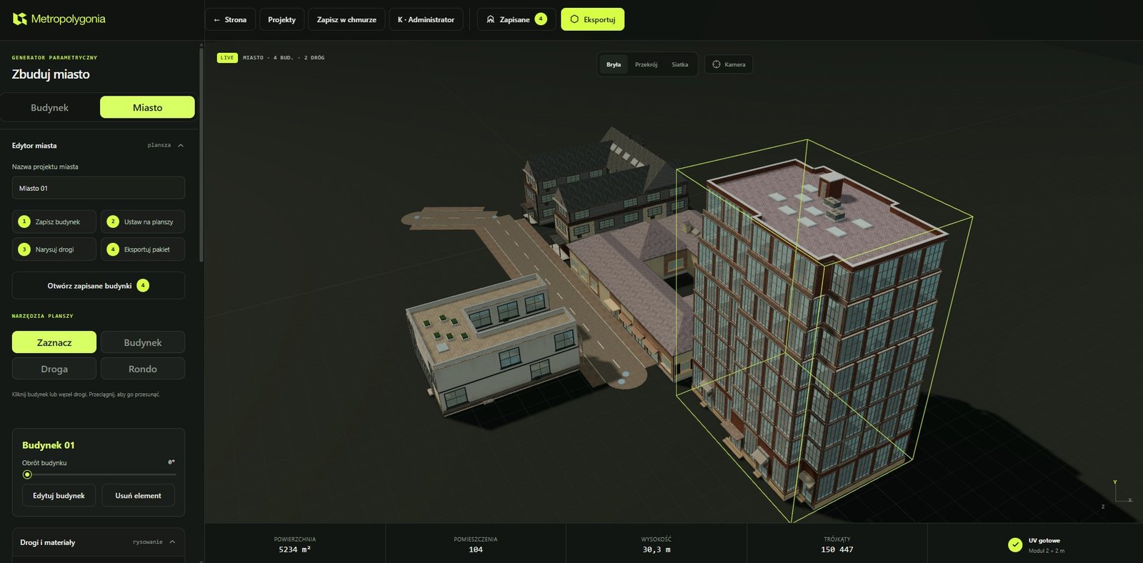
- BuildingsGenerated or placed from the saved-building library
- RoadsStraight and curved segments, junctions and roundabouts
- TerrainElevation controls, heightmap input and sculpt tools
- HandoffProject JSON, chunked assets and manifest v3
What the city generator does
The city workspace is a layout and asset-preparation tool. You can generate a district from explicit dimensions and density controls, or assemble a more deliberate layout by placing saved buildings and drawing the road network yourself. Building transforms, road definitions and terrain data remain editable project state.
This is not a zoning, traffic or engineering simulator. It does not certify building codes, generate bridges or tunnels, calculate structural performance, author navmeshes or finish a production game level. Its role is to make controllable urban base geometry and a traceable export package.
Generate a district or place approved buildings
Procedural district controls can populate a layout with varied buildings. For closer control, create a building in the building workspace, choose Save to city, then place that saved definition from the project library. Each placement can be positioned and rotated without changing the saved building parameters.
Individual placements can be selected and customized where the editor exposes overrides. The building generator remains the source for façade, roof, opening, interior and material parameters; the city editor owns layout and placement.
Draw roads, curves, intersections and roundabouts
The road tool supports configurable road types and lane counts, sidewalk dimensions, connected segments and curved geometry. Intersections are assembled from the connected graph, while roundabouts can be added as explicit road-network elements. A shared angle snap helps keep deliberate alignments without forcing every street into a rectangular grid.
Road elevations can follow a linear profile. Where terrain is active, cut/fill corridors reconcile the road surface with the surrounding elevation. The result still requires visual inspection around dense junctions, steep grades and unusual imported heightmaps.
Shape terrain and connect buildings to the ground
The terrain system supports project elevations, heightmap PNG sampling and interactive sculpt operations implemented in the current editor. Foundations can bring placed buildings to an appropriate base level, and city stairs can connect level changes where a pedestrian flight is needed.
These systems are procedural visual geometry, not civil-engineering calculations. Heightmaps, road corridors, foundations and stairs must be checked for the intended scale, clearances and downstream use.
Keep project state separate from delivery assets
City project JSON stores the editable layout. It is the file to keep when a road, building placement or terrain setting may change later. The city package is a delivery format: it can contain separate building GLBs, chunked terrain, road and infrastructure assets, plus a manifest describing origins, bounds, dependencies and the export scope.
The current chunk manifest is version 3. Full export includes the selected complete scope. Incremental export can package requested dirty chunks while retaining the complete chunk index in the manifest. This is a client-side workflow; an external deployment pipeline must persist previous signatures and replace the corresponding files atomically.
Follow the complete city creation and export guide or read the format reference.
What still belongs downstream
- Review topology, materials and scale in the target DCC or engine.
- Configure collisions, LODs, Nanite, lightmaps, navmeshes and World Partition in the target project when required.
- Test large exports on representative hardware; the browser creates and serializes geometry on the client.
- Treat terrain editing and destruction tools as beta or experimental where the interface labels them that way.
- Do not use the result as construction documentation, engineering analysis or proof of regulatory compliance.
City workflow questions
Can I reuse one building many times?
Yes. Save the building definition to the project library and create multiple placements with their own transforms.
Can I export only changed parts?
The current city package supports explicit or dirty chunk selection. The receiving pipeline still needs to manage previously exported files.
Does the package create a complete Unreal level?
No. It provides structured assets and manifest context. Unreal project configuration remains separate.